Active travel is coming into its own now that lockdown has been eased and, while cycling is the faster option, many people prefer to stay on the pavements and walk.
Currently the safest form of public transport is rail, however this does often require a longer walk at each end and you might prefer to walk to the High Street instead of driving or taking a bus. Checking online will quickly help you find the shortest route and give you an idea of how long it will take. Googlemaps is always useful in this way and, for the London area, the TFL website has introduced even more comprehensive advice for people looking to travel on foot in their dedicated walking section.
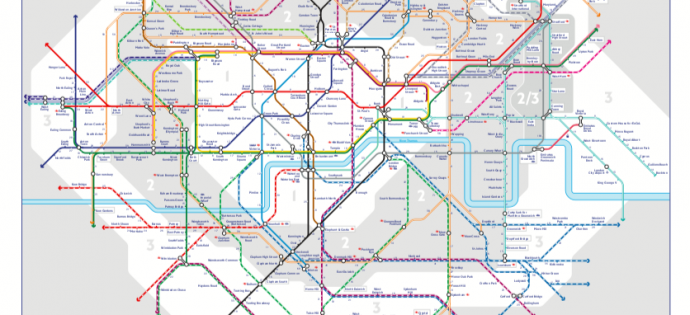
As well as handy route-planners with timings based on your walking speed, TLF also offers other useful tips and advice. There are maps showing timed walking distances between stations (main pic), which gives a useful sense of scale if you are avoiding the tube and one showing West End shops and attractions within 20 minutes of each other. There are also details of central London journeys quicker to walk.
Legible London maps and signs at street level are making it easier for people to find their way around and include realistic walking times, so you can check while you’re out and about.
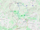
If you’re interested in something more recreational, the website also has details of the network of footpaths and greenways in the London area like the London Loop that passes through Barnet via the Dollis Valley Greenwalk and Hadley Woods and the Capital Ring taking in Highgate and the Parkland Walk.
Here is a link to the walking section on the TFL website.